Fishwives and Firestarters: a load of old Billingsgate

(A City of London Steeplechase, part 2)

This is my second ‘City of London Steeplechase’, a series of virtual guided walks that take in all 100 or so of the City of London’s churches, past and present, one Ward at a time. Having begun with the Tower Ward, moving clockwise to the west along the Thames our next stop is Billingsgate Ward.

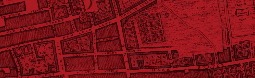
Billingsgate is a small, broadly rectangular plot of land situated between London Bridge and the Tower of London. It comprises four ancient lanes (Pudding Lane, Botolph Lane, Lovat Lane and St. Mary-at-Hill) that run northwards in parallel up a up a steep slope from the Thames as far as Eastcheap. The lanes are bisected by a number of smaller lanes and alleys running east-west, forming a rough grid pattern as shown in the maps below, from Strype’s edition of Stow’s Survey of London in 1720 and John Rocque’s map of 1746. The ward originally had five parish churches, all of which were destroyed or at least seriously damaged in the Great Fire. Three were rebuilt by Wren and two, St Margaret Pattens and St Mary-at-Hill, survive today among the City’s finest.

Billingsgate Ward from Strype, 1720


Billingsgate Ward from Rocque, 1746

Our walk begins at Monument Underground station. Leaving the station into Fish Street Hill, turn left up the hill and immediately right along Eastcheap and then right again into Pudding Lane.

As every schoolchild knows, Pudding Lane is where the Great Fire of London was started, shortly after midnight on Sunday, 2 September 1666. The exact site of the start of the fire is down at the bottom of the lane, and we’ll visit it later on in our walk. Our first destination, however, is the site of St George, Botolph Lane, one of the 15 or so Wren churches that have disappeared from London’s skyline. There is very little sign of St George’s now – not even a blue plaque – but if you look carefully as you walk down Pudding Lane to St.George’s Lane you should see an iron parish boundary marker set low down on a wall on the left hand side.

St George Botolph Lane boundary mark, Pudding Lane

Turn left into St.George’s Lane. An unprepossessing view, lined with ugly office blocks, compares poorly with what one would have seen until 1904 when St.George’s was demolished.

View east down St George’s Lane, 2015


View east down St George’s Lane before 1904


Doorway of St George Botolph Lane, St George’s Lane, shortly before demolition in 1904

At the end of St George’s Lane, cross over Botolph Lane and continue through the narrow passageway into Botolph Alley.

Half way down Botolph Alley look up on the left hand side for another parish boundary mark for St. George Botolph Lane. Notice how close you are to the tower of St Mary-at-Hill in front of you at the end of the alley – a great demonstration of how small the City’s medieval parishes were!

Parish boundary mark for St George Botolph Lane in Botolph Alley


View east along Botolph Alley to St Mary-at-Hill church (note parish boundary mark bottom left)

St Mary-at-Hill is one of the City’s lesser-known beauties. Probably originally built in the C12th, it was severely damaged but not destroyed in the Great Fire and Wren’s rebuilding made use of much of the previous structure including the north and south walls. The church escaped serious damage in the Blitz but sadly much of its fine internal furniture was damaged in a major fire in 1988 and remains in storage.

Enter through the west door from Lovat Lane and take a look round the vestibule. On your left high on the wall is a monument to one Isaac Millner – this is a relic from St George Botolph Lane, rescued when that church was demolished.

Vestibule of St Mary-at-Hill (monument from St George Botolph Lane)

Below it is a real gem: a large carved stone tablet known as a ‘Resurrection Panel’ depicting the Last Judgement. It is believed to date from the 1670s and is one of four known such works in London.

Resurrection Panel in St Mary-at-Hill vestibule


Resurrection Panel in St Mary-at-Hill (detail)

The scene is from Revelation 20.13: The sea gave up the dead which were in it; and death and Hell gave up the dead which were in them, and each person was judged according to what he had done. At the top, Christ stands triumphant with his banner, trampling Satan, while angels appear from the clouds blowing trumpets to awaken the dead. Below, coffins spew out their awakened dead. St Michael helps up one figure and guides him towards Heaven to the left and away from the gaping jaws of Hell to the right.

Note also in the vestibule some attractive wooden panelling, dated 1672 with the carved names of the churchwardens of the time.

Panellling in St Mary-at-Hill vestibule (1672)

Inside the church all is surprisingly bare apart from the beautiful domed ceiling and the organ. This is a reflection of the 1988 fire (see below); thankfully the splendid 1848 organ, considered to be one of London’s finest, has been restored to its former glory.

St Mary-at-Hill after the fire of 1988


The dome of St Mary-at-Hill


St Mary-at-Hill, east end and dome


St Mary-at-Hill, organ

Leave the church and turn right up Lovat Lane. On this narrow cobbled hill, it is easy to forget that you are in the middle of the City.

St Mary-at-Hill from Lovat Lane


Gaudi-esque windows on Lovat Lane


Old anchor sign on Lovat Lane


Old sign on Lovat Lane


Corner of Lovat Lane and Eastcheap

At the top of Lovat Lane, cross Eastcheap and turn to look back. No.16 Eastcheap, occupying the block between Botolph Lane and Lovat Lane, is the site of another disappeared church, that of St Andrew Hubbard. This church, which was destroyed in the Great Fire, has left even fewer traces than St.George Botolph. A blue plaque that adorned the site has gone, and the only signs I know of are two parish boundary markers in nearby Philpot Lane and Talbot Court.

16 Eastcheap, site of St Andrew Hubbard


Parish boundary mark for St Andrew Hubbard

Now continue eastwards along the north side of Eastcheap until you reach the next turning on the left where you will find the church of St Margaret Pattens, with its pretty little paved courtyard faced with some attractive old shop buildings.

St Margaret Pattens is first recorded as early as 1067 as a small wooden building, which was replaced in stone in the early medieval period and rebuilt again in 1538. Destroyed in the Great Fire, the church was rebuilt by Wren and completed, with its lead-covered timber spire (the only such Wren structure remaining in London) in 1702.

St Margaret Pattens with Walkie-Talkie


Round windows, St Margaret Pattens


Doorcase, St Margaret Pattens


Old shop premises, Eastcheap

Beautiful on the outside, the interior is also well worth a long look. In the vestibule is a small museum to the worshipful companies of pattenmakers and basketmakers. Among the glories inside the church are a particularly fine set  of Royal Arms (Charles II); a rare pair of canopied churchwardens’ pews (one for the church of St Gabriel Fenchurch destroyed in the Great Fire and subsumed into St Margaret’s parish); and a couple of fine sword rests. Set in the floor is a tablet to Gordon Huelin (1919-1997), former Guild Vicar of St Margarets and author of ‘Vanished Churches of the City of London‘, one of my main sources for this series of posts!

Organ and Royal Arms, St Margaret Pattens


Royal Arms, St Margaret Pattens (detail of lion)


Royal Arms, St Margaret Pattens (detail of unicorn)


Monument, St Margaret Pattens


Sword Rest, St Margaret Pattens


Exquisite carving, St Margaret Pattens


Stained Glass (Pattenmakers’ Company), St Margaret Pattens


Stained Glass (Basketmakers’ Company), St Margaret Pattens


Stine tablet to Gordon Huelin, St Margaret Pattens


Gordon Huelin


Vanished Churches of the City of London

Re-cross Eastcheap and head down St Mary-at-Hill, pausing to admire the view both down the hill, with the Shard dominant, and back up the hill to St Margaret’s. Passing down on the right you will come to the east end of St Mary’s with its lovely protruding clock, at which point you may struggle to reconcile that west and east faces are indeed of the same church, with the classical and stuccoed east end in sharp contrast to the brick tower and west face. Note also the lead rainwater pipes and the doorcase with skull & crossbones motif.

View of the Shard down St Mary-at-Hill


View of St Margaret Pattens past the St Mary-at-Hill clock


St Mary-at-Hill, clock


St Mary-at-Hill, east front


Skull & bones doorcase, St Mary-at-Hill


Skull & bones doorcase, St Mary-at-Hill (detail)


The Walkie-Talkie and St Mary-at-Hill

It is worth a brief diversion down the alleyway leading to the tiny churchyard with its pile of broken gravestones and the Victorian sign announcing the closure of the ground to further burials.

Churchyard of St Mary-at-Hill


Sign on north wall of St Mary-at-Hill


North porch of St Mary-at-Hill

Towards the bottom of the hill on the right you will see an attractive Georgian building. This is Watermens’ Hall, home of the Worshipful Company of Watermen and the only surviving Georgian livery hall in London.

Watermens’ Hall, St Mary-at-Hill


Watermens’ Hall


A Thames Waterman , wearing Doggett’s Coat & Badge

At the bottom of the hill, you will find yourself at the end of Monument Street looking up to the Monument on your right and with the former Billingsgate Market, with its distinctive Britannia statue on the roof, facing you across the busy traffic of Lower Thames Street. On this corner to your left was another wonder of London architecture that is sadly no longer with us: the old Coal Exchange. Built in 1849 in cast iron, one of the first buildings so structured, it was later described as ‘the prime city monument of the early Victorian period’ and ‘a landmark in the history of early iron construction’. Despite protests, it was demolished in 1962 to enable the widening of Lower Thames Street. Cast iron dragons which were mounted on the parapet above the entrance were preserved and were erected as boundary marks in Temple Gardens on Victoria Embankment.

Old Billingsgate, with Shard behind


Billingsgate, early morning


Britannia statue on roof of Old Billingsgate


Model for former Coal Exchange

If time permits it is worth a detour here across Lower Thames Street to explore the riverside frontage of the former Billingsgate fish market. This is the site of an ancient watergate of the City: the name Billingsgate is first recorded in Geoffrey of Monmouth’s ‘History of the Kings of Britain’ (c.1136) as the work of one Belinus, an Iron Age king in c.400BC:

In the town of Trinovantum [London] Belinus caused to be constructed a gateway of extraordinary workmanship, which in his time the citizens called Billingsgate, from his own name. … Finally, when his last day dawned and carried him away from this life, his body was cremated and the ash enclosed in a golden urn. This urn the citizens placed with extraordinary skill on the very top of the tower in Trinovantum which I have described.

Writing in 1603, Stow described Billingsgate as a busy waterside community with the quaysides thronged with all shapes and sizes of boats unloading fish, salt, oranges, onions, corn, sea coal and ale, ‘for service of the Citie, and the parts of this Realme adjoyning’. The quay had had rights to charge ships for docking since the reign of Edward III and a permanent fish market was established in 1699.

The present buildings were designed by Horace Jones in 1875 and sensitively renovated by Richard Rogers following the fish market’s relocation to Canary Wharf in 1982. It is now an entertainment and business venue, with no trace left of the chaos and noise of lorries and barrows packed with fish that were the hallmark of this area for centuries. During this time Billingsgate became synonymous for profanity and offensive language, together with the raucous street cries of the fish sellers. Writing in 1861 Henry Mayhew described the scene:

The wooden barn-looking square where the fish is sold, is soon after six o’clock crowded with shiny cord jackets and greasy caps. Everybody comes to Billingsgate in his worst clothes, and no-one knows the length of time a coat can be worn until they have been to a fish sale…over the hum of voices is heard the shouts of the salesmen who…stand on their tables, roaring out their prices…all are bawling together…till the place is a perfect Babel of competition. “Ha-a-ansome cod! best in the market! All alive! alive! alive O!” “Ye-o-o! Ye-o-o! here’s your fine Yarmouth bloaters!” …and much more.

Former Billingsgate market, south view.


Former Billingsgate market, dolphin weathervanes


Dolphin weathervane, old Billingsgate


Billingsgate porters at work looking up St Mary-at-Hill

When you have tired of Billingsgate, cross back over Lower Thames Street and head back up Monument Street towards the Monument. Stop to admire the view back up Lovat Lane:

The view back up Lovat Lane from Monument Street

At the corner of Botolph Lane on the right you will see some iron gates barring entry to what looks like a tiny garden, bearing a sign ‘One Tree Park’ (there are two!). This miserable-looking piece of ground is the only visible remnant of our last parish church for today: part of the burial ground of St Botolph Billingsgate. There were four City churches dedicated to St Botolph, a C7th English abbot who is a patron saint of travellers. These churches were sited at main entrances to the City at the four main compass points: St Botolph Aldgate to the east, St Botolph Bishopsgate to the north, St Botolph Aldersgate to the west and St Botolph Billingsgate to the south. Of the church itself there are no visible remains, though various elements have been found during archaeological excavations around the Billingsgate site.

One Tree Park

Patterned wall of St Botolph Billingsgate, uncovered during excavations at Billingsgate Lorry Park

Continue up Monument Street and turn right up Pudding Lane to return to Monument tube. As you round the corner past Faryners House, try not to miss the small and rather scruffy sign that marks the site of Thomas Faryner’s bakery where the Great Fire began.

Faryners House, Monument Street


Sign on Faryners House marking the start of the Great Fire of London in 1666

As the Museum of London puts it:

At 1am on Sunday 2 September Thomas and his family were woken by smoke. The household escaped through a window to the roof of a neighbour and raised the alarm. Thomas later said that as he had left he could see that the fire had not started near his oven. He also insisted he had extinguished the fire before going to bed and that no window or door had been open so a draught could not have re-lit the fires. He did admit that some wood had been left next to the ovens so it would be dry in the morning. Amazingly he seems to have escaped blame and returned to baking after the fire. It is now accepted that a spark or ember from his oven was probably responsible.

The rest, as they say, is history.

That completes our second City of London steeplechase!

If you have enjoyed this, I have compiled a separate Storify page here with links to relevant videos, articles and blog posts by other writers that bring further life to this part of the City of London. These include several clips on Billingsgate Market, with old footage of the market porters, some pieces about Billingsgate profanity, and (by way of contrast!) a lovely choral interlude filmed in St Mary-at-Hill. Hope you like it!

City of London Churches: digital sketches

I’ve been taking a lot of photos lately to support my ongoing City of London Steeplechase post series. I’ve been exploring ways of playing with the images to bring out some of the finer architectural details, and thought I’d share some of the results as a separate post.

The images below cover pretty much the entire historical range of the City churches, from the Norman round nave of Temple Church and the Medieval towers of St Sepulchre-without-Newgate and St Olave Hart Street, through a number of some of Wren’s finest works, their embellishment by Hawksmoor and on to the post-Blitz redesigned steeple of All Hallows Barking.

I’ll start with one of my favourites: Wren’s beautiful steeple at St Mary-le-Bow, with its magnificent dragon weathervane neatly silhouetted against the skyline. You can find out more about the dragon, and its relationship with the nearby grasshopper vane on the Royal Exchange, by clicking here.

St Mary-le-Bow


The next image brings to life the remarkable detail of Hawksmoor’s pinnacles on Wren’s St Michael Cornhill:

St Michael Cornhill


Another of my favourites: the dome and tower of Wren’s gorgeous St Stephen Walbrook; a joy to see both inside and out.

St Stephen Walbrook


The round nave at Temple Church; one of the City’s few remaining Norman buildings:

Temple Church


The tower of St Sepulchre-without-Newgate. Note the four weathervanes which always seem to point in different directions, giving rise to an old saying about unreasonable people: ‘as hard to reconcile as the vanes on St Sepulchre’s tower’:

St Sepulchre-without-Newgate


Next, another Wren masterpiece: St Mary Abchurch. Quaint on the outside, the interior with its floodlit dome is stunning, but I’ll save that for another Steeplechase.

St Mary Abchurch


St Vedast-alias-Foster: one of the strangest among many strangely named City churches, and in my view quite a physically strange building too, with its bulky steeple that seems to me a bit disproportionate to the tower beneath:

St Vedast-alias-Foster


Now to St Olave, Hart Street, resting place of Samuel Pepys and the church that Dickens christened St Ghastly Grim because of the gruesome skulls decorating its churchyard wall. You can read more about this lovely old church and its remarkable history by clicking here.

St Olave Hart Street


Near to St Olave’s is the City’s oldest church, All Hallows Barking, or All Hallows-by-the-Tower as it is also known. While the elegant steeple looks old, it is in fact a post-war creation after the previous, much smaller, one was destroyed in the Blitz. For more detail, including pictures of the fascinating museum in the crypt, click here.

All Hallows Barking


I’ll finish with another of Wren’s glories, that of St Mary Aldermary, which could perhaps be described as ‘Christopher Wren goes Gothic’ with its fan-vaulted ceiling.

St Mary Aldermary


I hope you liked these. Do let me know what you think (see comment form below), and I’ll see if I can cook up some more in due course…

Poppies and Pepys and Ghastly Grim: a City of London Steeplechase Part 1

This is the first of a collection of posts – I’ll call them Steeplechases – in which I aim to cover all the City of London’s churches, past and present, in a format that will align to series of short walks. Each post in the series will take in a small number of church sites and a few other points of interest along the way.

As a collection of buildings, the City churches have evolved considerably over the centuries. Estimates differ of the exact number of in existence at various points in time, but a good approximation to the overall number is that there are just under 50 churches active today, with standing remains of 10 others, compared with just over 100 recorded parishes at the time of the Great Fire in 1666. Most of the churches originally date from the C12 and C13, although at least a quarter of them were recorded before 1100.

The scale of the Great Fire was such that 86 churches were burnt out, providing a blank canvas for the genius of Wren, Hooke and Hawksmoor, who rebuilt about 50 of them. More than 30, then, disappeared from London’s skyline at that point and there is little or no evidence of their existence on the ground today, other than in many cases a Corporation of London blue plaque to mark the site.

Four of the churches destroyed in the Great Fire of London and not rebuilt

Perhaps the greatest surprise to a newcomer to the history of the City churches is the fact that a further 25 or so churches, including some 15 of Wren’s, were demolished between 1780 and 1940 in what is generally today seen as a period of gross vandalism by the public authorities. This left just under 50 Anglican churches standing at the beginning of World War II, of which more than one-third were gutted by bombing during the war. The changed attitudes to conservation since 1945 have meant that most war-damaged churches were rebuilt and in some cases ruins preserved.

The first challenge in setting about this project was how to group the churches in a way that will be helpful to readers who may be unfamiliar with the ground and able to cover only a short distance on each walk. After considering various options, I decided to base the walks on the 26 historic wards of the City as they were at the time of John Strype’s survey of London in 1720.

Where to start? In light of the popularity of the remarkable and moving installation ‘Blood Swept Lands and Seas of Red’, with its poppies providing the Tower of London with an even stronger tourist magnet than usual, I am going to start with the adjacent Tower Ward. 

  
In 1720 this ward contained just three parish churches, so it will be a relatively short walk, but the churches concerned are some of the City’s most historically interesting and there is plenty to see and explore in a walk that can easily be bolted on to a visit to the Tower.

The three churches of the Tower Ward (All Hallows Barking, St Dunstan-in-the-East and St Olave Hart Street) are a perfect illustration of the evolution and violent revolution of the City Church buildings. All three churches were of early medieval or earlier origin; two survived the Great Fire relatively unscathed; all three were devastated by the Blitz but only two were subsequently restored. The resulting buildings exemplify perfectly the palimpsest of architectural styles from Saxon to modern that so distinguishes the City Churches, and so form a great introduction to our ‘steeplechases’.

Blood Swept Lands and Seas of Red

Planting the Poppies

Tribute to a fallen relative

Starting from your vantage point looking over the poppies at Tower Hill, look west and you should not fail to notice the striking copper-green spire of All Hallows-by-the-Tower, or All Hallows Barking to give its correct name, referring to its connection with the ancient Barking Abbey.

All Hallows Barking

This is the oldest church in the City, first mentioned in 1086 and the only London church with standing Anglo-Saxon fabric. It’s an astonishing building that looks almost entirely medieval from the outside but whose interior reveals a modern but sensitive restoration, (partly in concrete!) after very severe damage in the Second World War.

All Hallows Barking, interior

Perhaps its greatest asset is the Grinling Gibbons font cover, kept behind locked glass doors but open to view, but of equally great interest is the crypt, which houses an eclectic range of artefacts from Roman and Saxon remains to the crow’s nest from the ship of Ernest Shackleton, the polar explorer.

Grinling Gibbons font cover, detail

Model of Roman London

Roman floor from a domestic house on the site of the church

Cast of a Roman tombstone: “in memory of Flavius Agricola, soldier of the Sixth Legion, ‘the Victorious’. He lived 42 years, 10 days. Albua Faustina set this up to her incomparable husband”

The City of London’s oldest Saxon arch

Saxon cross found under the nave during renovation in 1951

C14 alabaster carving depicting the legend of St Hubert (d.727 AD)

Baptism record of William Penn, founder of Pennsylvania, 23 October 1644

Crow’s nest from Shackleton’s last polar expedition ship, ‘Quest’

All Hallows Barking on the Agas map (1560-1605?), next to ‘Towre Hyll’.

The brick tower of All Hallows dates from 1658-9, replacing what appears from the Agas map (1560-1605?) to have been a similar structure; and so was almost new when Samuel Pepys ascended it on 5 September 1666 to view the devastation of the Great Fire, which a little earlier had reached the porch of the church itself before being diverted:

“I up to the top of Barking steeple, and there saw the saddest sight of desolation that I ever saw; every where great fires, oyle-cellars, and brimstone, and other things burning. I became afeard to stay there long, and therefore down again as fast as I could, the fire being spread as far as I could see it…”

It was a surprise to me to learn that the elegant steeple dates only from the post-war restoration in 1958. Previously, and in Pepys’ day, the tower was crowned by a much smaller edifice as illustrated by a model in the crypt museum.

Model of All Hallows as it looked before WW2

All Hallows minus steeple during restoration work in 1955 (Source: http://commons.m.wikimedia.org/wiki/File:London_Great_Tower_Street_geograph-3066471-by-Ben-Brooksbank.jpg)

The post-WW2 steeple (1958) of All Hallows Barking (detail)

Another major change in recent years is in the church’s external context relative to the adjacent street pattern. Now almost marooned on an island between the Thames, the Tower Moat and the heavy traffic of Lower Thames Street, All Hallows would in past times have felt much more part of the City, with the main thoroughfare of Great Tower Street then passing to the south of the church, rather than to its north as today as can be seen from Strype’s map below:

Tower Ward from Strype’s map of 1720. Note the position of All Hallows (bottom right) in relation to Seething Lane and Tower Street is very different to that of today.

Angel with City of London arms guarding the north porch

Leaving All Hallows from the north porch, head westwards and cross over Lower Thames Street to take in the Hung, Drawn & Quartered pub.  The pub’s name reflects the fact that until the mid-18th century, Tower Hill was London’s main location for public executions, particularly in respect of treason, for which the punishment of hanging, drawing and quartering was reserved. A sign on the wall outside bears a quotation from Pepys’ diary about the execution of Thomas Harrison, one of the men responsible for the execution of Charles I (ironically Harrison was executed at Charing Cross, not Tower Hill).

The Hung, Drawn and Quartered

Quote from Pepys’ diary

Cross back over Lower Thames Street and head down Water Lane to the Thames. If the tide is out, there are steps down to a stretch of exposed foreshore here in front of Custom House – look out for the mark on the river wall denoting the parish boundary between All Hallows Barking and St Dunstan-in-the-East. This is a good spot for mudlarking and will always yield a few pieces of old clay pipes. Health & Safety warning – (1) make sure you check the tide times; (2) make sure you understand the rules about poking about on the foreshore; and follow sensible guidance about cleanliness in handling anything you pick up from the Thames.

Parish boundary between St Dunstan-in-the-East and All Hallows Barking on the Thames wall at Custom House

Clay pipe mudlarking finds from Custom House foreshore

When you’ve had your fill of the foreshore, walk back to Lower Thames Street and head west, crossing just after you see the buttressed spire of the ruined St Dunstan-in-the-East on the other side of the road.

St Dunstan-in-the-East, from Lower Thames Street

St Dunstan’s has had the misfortune of being devastated by both the Great Fire and the Blitz and a major rebuilding in between. The original medieval church was an important foundation and was physically imposing with a leaded steeple thought to have been second in height only to Old St Paul’s.

St Dunstan-in-the-East on the Agas map (1560-1605?)

St Dunstan-in-the-East from the Visscher panorama (1616)

The rebuilding of St Dunstan’s after the Great Fire was able to re-use much of the medieval fabric, and Wren’s distinctive tower and spire were the main new elements. However, by the early C19 the medieval walls had become dangerously unstable and they were knocked down and replaced (though maintaining Wren’s spire) by a new building in 1817-21 by David Laing.

David Laing’s St Dunstan-in-the-East, before being destroyed in the Blitz. Source: http://spitalfieldslife.com/2013/05/07/the-city-churches-of-old-london/b1342/

Laing’s church was itself destroyed by bombing in 1941, though Wren’s tower and steeple again survived. Walk up the hill to the church and take in the beautiful gardens that have been allowed to develop in the church ruins.

Wren’s tower at St Dunstan-in-the-East

Fig tree in St Dunstan’s garden

Plaque commemorating the foundation of St Dunstan’s College, 1466

St Dunstan-in-the-East, railings (detail)

For the final leg of our steeplechase, continue up St Dunstan’s Hill to Great Tower Street, cross the road and head east back towards the spire of All Hallows.

All Hallows and the Tower of London, from Great Tower Street

Turn left onto Mark Lane and then right onto Hart Street, stopping to note The Ship, a grade-II listed pub dating from 1802.

The Ship, Hart Street

A bit further on the right is St Olave, Hart Street, one of the City’s smallest churches but, like All Hallows, well worth a lengthy visit in its own right. First recorded in the late 12th century, it is packed full of interesting monuments, including those to Samuel Pepys and his wife Elizabeth: this was their parish church and they are both buried here. One monument in particular, that to Dr Peter Turner (d.1614) has a fascinating history: it was looted from the bombed ruins of the church in 1941 and rediscovered in 2010 when it came up for sale in an auction! It was subsequently restored to its rightful place in the church.

Relief of St Olave on the vestry wall, Hart Street

Monument to the Bayninge brothers (d.1610 and 1616)

Monument to Sir James Deane, d.1608

Monument to Peter Turner, d.1614

Monument to Samuel Pepys

Monument to Elizabeth Pepys

Before leaving St Olave’s, make sure you take in the small secluded churchyard which leads out to Seething Lane where you will see the gateway of 1658 with its carved skulls and bones.

St Olave, Hart Street: Seething Lane gateway

St Olave’s gateway (detail)

This ghoulish sight led Charles Dickens to immortalise the church in The Uncommercial Traveller as ‘St Ghastly Grim’:

…It is a small small churchyard, with a ferocious, strong, spiked iron gate, like a jail. This gate is ornamented with skulls and cross-bones, larger than the life, wrought in stone; but it likewise came into the mind of Saint Ghastly Grim, that to stick iron spikes a-top of the stone skulls, as though they were impaled, would be a pleasant device. Therefore the skulls grin aloft horribly, thrust through and through with iron spears. Hence, there is attraction of repulsion for me in Saint Ghastly Grim, and, having often contemplated it in the daylight and the dark, I once felt drawn towards it in a thunderstorm at midnight. ‘Why not?’ I said, in self-excuse. ‘I have been to see the Colosseum by the light of the moon; is it worse to go to see Saint Ghastly Grim by the light of the lightning?’ I repaired to the Saint in a hackney cab, and found the skulls most effective, having the air of a public execution, and seeming, as the lightning flashed, to wink and grin with the pain of the spikes. Having no other person to whom to impart my satisfaction, I communicated it to the driver. So far from being responsive, he surveyed me — he was naturally a bottled-nosed, red-faced man — with a blanched countenance. And as he drove me back, he ever and again glanced in over his shoulder through the little front window of his carriage, as mistrusting that I was a fare originally from a grave in the churchyard of Saint Ghastly Grim, who might have flitted home again without paying.


St Ghastly Grim…

To complete the circuit, continue south along Seething Lane to return to All Hallows Barking and Tower Hill underground station.

Did you enjoy this post? Please feel free to comment! If you did like it, you might like to read about the Dragon and the Grasshopper here.