
This is the first of a collection of posts – I’ll call them Steeplechases – in which I aim to cover all the City of London’s churches, past and present, in a format that will align to series of short walks. Each post in the series will take in a small number of church sites and a few other points of interest along the way.
As a collection of buildings, the City churches have evolved considerably over the centuries. Estimates differ of the exact number of in existence at various points in time, but a good approximation to the overall number is that there are just under 50 churches active today, with standing remains of 10 others, compared with just over 100 recorded parishes at the time of the Great Fire in 1666. Most of the churches originally date from the C12 and C13, although at least a quarter of them were recorded before 1100.
The scale of the Great Fire was such that 86 churches were burnt out, providing a blank canvas for the genius of Wren, Hooke and Hawksmoor, who rebuilt about 50 of them. More than 30, then, disappeared from London’s skyline at that point and there is little or no evidence of their existence on the ground today, other than in many cases a Corporation of London blue plaque to mark the site.

Four of the churches destroyed in the Great Fire of London and not rebuilt
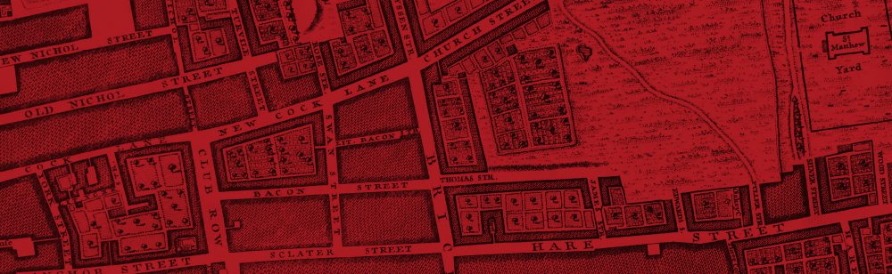
The first challenge in setting about this project was how to group the churches in a way that will be helpful to readers who may be unfamiliar with the ground and able to cover only a short distance on each walk. After considering various options, I decided to base the walks on the 26 historic wards of the City as they were at the time of John Strype’s survey of London in 1720.
Where to start? In light of the popularity of the remarkable and moving installation ‘Blood Swept Lands and Seas of Red’, with its poppies providing the Tower of London with an even stronger tourist magnet than usual, I am going to start with the adjacent Tower Ward.

In 1720 this ward contained just three parish churches, so it will be a relatively short walk, but the churches concerned are some of the City’s most historically interesting and there is plenty to see and explore in a walk that can easily be bolted on to a visit to the Tower.
The three churches of the Tower Ward (All Hallows Barking, St Dunstan-in-the-East and St Olave Hart Street) are a perfect illustration of the evolution and violent revolution of the City Church buildings. All three churches were of early medieval or earlier origin; two survived the Great Fire relatively unscathed; all three were devastated by the Blitz but only two were subsequently restored. The resulting buildings exemplify perfectly the palimpsest of architectural styles from Saxon to modern that so distinguishes the City Churches, and so form a great introduction to our ‘steeplechases’.

Blood Swept Lands and Seas of Red

Planting the Poppies

Tribute to a fallen relative

All Hallows Barking

All Hallows Barking, interior

Grinling Gibbons font cover, detail

Model of Roman London

Roman floor from a domestic house on the site of the church

Cast of a Roman tombstone: “in memory of Flavius Agricola, soldier of the Sixth Legion, ‘the Victorious’. He lived 42 years, 10 days. Albua Faustina set this up to her incomparable husband”

The City of London’s oldest Saxon arch

Saxon cross found under the nave during renovation in 1951

C14 alabaster carving depicting the legend of St Hubert (d.727 AD)

Baptism record of William Penn, founder of Pennsylvania, 23 October 1644

Crow’s nest from Shackleton’s last polar expedition ship, ‘Quest’

All Hallows Barking on the Agas map (1560-1605?), next to ‘Towre Hyll’.
“I up to the top of Barking steeple, and there saw the saddest sight of desolation that I ever saw; every where great fires, oyle-cellars, and brimstone, and other things burning. I became afeard to stay there long, and therefore down again as fast as I could, the fire being spread as far as I could see it…”
It was a surprise to me to learn that the elegant steeple dates only from the post-war restoration in 1958. Previously, and in Pepys’ day, the tower was crowned by a much smaller edifice as illustrated by a model in the crypt museum.

Model of All Hallows as it looked before WW2

All Hallows minus steeple during restoration work in 1955 (Source: http://commons.m.wikimedia.org/wiki/File:London_Great_Tower_Street_geograph-3066471-by-Ben-Brooksbank.jpg)

The post-WW2 steeple (1958) of All Hallows Barking (detail)

Tower Ward from Strype’s map of 1720. Note the position of All Hallows (bottom right) in relation to Seething Lane and Tower Street is very different to that of today.

Angel with City of London arms guarding the north porch

The Hung, Drawn and Quartered

Quote from Pepys’ diary

Parish boundary between St Dunstan-in-the-East and All Hallows Barking on the Thames wall at Custom House

Clay pipe mudlarking finds from Custom House foreshore

St Dunstan-in-the-East, from Lower Thames Street

St Dunstan-in-the-East on the Agas map (1560-1605?)

St Dunstan-in-the-East from the Visscher panorama (1616)

David Laing’s St Dunstan-in-the-East, before being destroyed in the Blitz. Source: http://spitalfieldslife.com/2013/05/07/the-city-churches-of-old-london/b1342/

Wren’s tower at St Dunstan-in-the-East

Fig tree in St Dunstan’s garden

Plaque commemorating the foundation of St Dunstan’s College, 1466

St Dunstan-in-the-East, railings (detail)

All Hallows and the Tower of London, from Great Tower Street

The Ship, Hart Street

Relief of St Olave on the vestry wall, Hart Street

Monument to the Bayninge brothers (d.1610 and 1616)

Monument to Sir James Deane, d.1608

Monument to Peter Turner, d.1614

Monument to Samuel Pepys

Monument to Elizabeth Pepys

St Olave, Hart Street: Seething Lane gateway

St Olave’s gateway (detail)
…It is a small small churchyard, with a ferocious, strong, spiked iron gate, like a jail. This gate is ornamented with skulls and cross-bones, larger than the life, wrought in stone; but it likewise came into the mind of Saint Ghastly Grim, that to stick iron spikes a-top of the stone skulls, as though they were impaled, would be a pleasant device. Therefore the skulls grin aloft horribly, thrust through and through with iron spears. Hence, there is attraction of repulsion for me in Saint Ghastly Grim, and, having often contemplated it in the daylight and the dark, I once felt drawn towards it in a thunderstorm at midnight. ‘Why not?’ I said, in self-excuse. ‘I have been to see the Colosseum by the light of the moon; is it worse to go to see Saint Ghastly Grim by the light of the lightning?’ I repaired to the Saint in a hackney cab, and found the skulls most effective, having the air of a public execution, and seeming, as the lightning flashed, to wink and grin with the pain of the spikes. Having no other person to whom to impart my satisfaction, I communicated it to the driver. So far from being responsive, he surveyed me — he was naturally a bottled-nosed, red-faced man — with a blanched countenance. And as he drove me back, he ever and again glanced in over his shoulder through the little front window of his carriage, as mistrusting that I was a fare originally from a grave in the churchyard of Saint Ghastly Grim, who might have flitted home again without paying.

St Ghastly Grim…
Did you enjoy this post? Please feel free to comment! If you did like it, you might like to read about the Dragon and the Grasshopper here.
